
Industry
International Development
Challenge
Early warning systems need more than flood hazard maps. Decision-makers also need to understand where buildings, villages, and vulnerable communities are most exposed so preparedness efforts can be prioritised.
Results
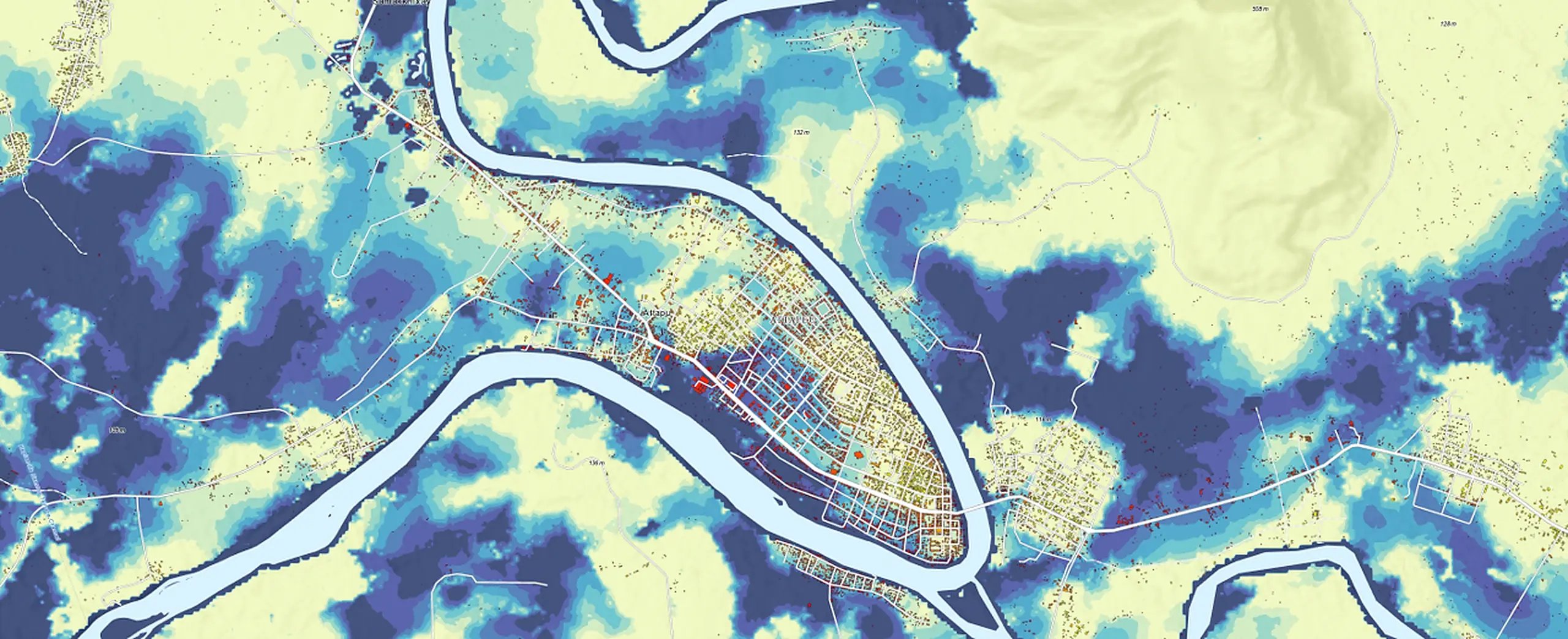
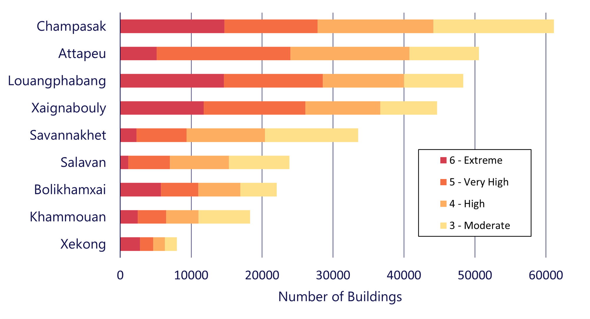
Geoneon developed a screening-level flood susceptibility, exposure, vulnerability and risk assessment across nine provinces of Lao PDR. The assessment analysed more than 2.75 million buildings, identifying 310,403 buildings (11.3%) in moderate-to-extreme flood exposure categories, corresponding to more than 0.5 m of modelled flooding, and 30 villages where at least 90% of buildings fell within these categories.
Key Product
Geoneon Flood
About
This study was produced by Geoneon under the ACER-SEA (Addressing Climate and El Niño-Related Risks in Southeast Asia) project for the Swiss Agency for Development and Cooperation (SDC) and People in Need (PIN).
The work also incorporated village-level flood vulnerability data developed by the Asian Disaster Preparedness Center (ADPC) to connect modelled flood exposure with community vulnerability and risk.
The Challenge
Flooding is one of the most severe and recurrent natural hazards in Lao PDR.
For early warning system planning, understanding where flooding may occur is only part of the challenge. Equally important is understanding where flooding is most likely to affect people, buildings, and communities.
Hazard maps alone cannot answer questions such as:
- Which villages should be prioritised for early warning investment?
- Where are buildings most exposed to flood depths that could significantly affect communities?
- Where should preparedness planning and mitigation efforts be focused first?
The project set out to develop a screening-level evidence base that connects modelled flood behaviour with exposure and vulnerability to support more targeted early warning planning.
The Solution
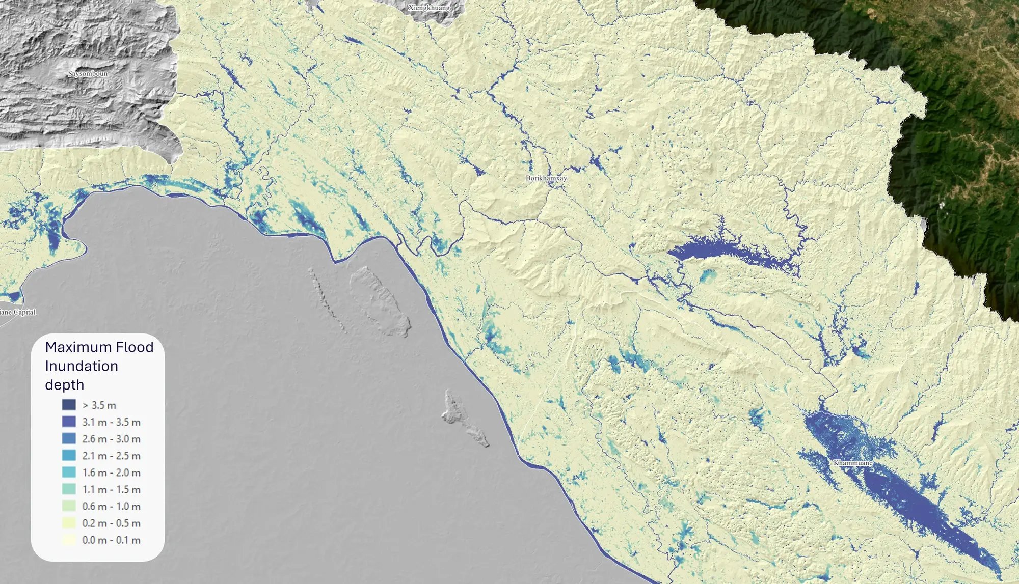
Geoneon developed a 30 m flood susceptibility model using the open-source SynxFlow hydrodynamic model, then combined modelled flood depths with building footprints, village boundaries and village-level vulnerability data to assess exposure, vulnerability and risk across nine provinces.
Rather than forecasting a specific flood event, the project established a screening-level evidence base to support early-warning-system planning, disaster risk reduction, adaptation planning and prioritisation.
The Results
The assessment provided a building-level, near-national-scale flood susceptibility and risk evidence base across the nine study provinces.
Key outcomes included:
- analysis of more than 2.75 million buildings
- 310,403 buildings (11.3%) classified in moderate-to-extreme flood exposure categories, corresponding to more than 0.5 m of modelled flooding
- 30 villages where at least 90% of buildings fell within those exposure categories
Verification against the 2019 Xe Khong flood event showed strong agreement with satellite-derived flood extents, while also identifying limitations associated with the available input and validation data.
The assessment demonstrated how connecting flood modelling with buildings, villages and vulnerability information provides a stronger basis for prioritising early warning systems and preparedness planning than hazard mapping alone.
As higher-resolution elevation data, local surveys and additional validation become available, the assessment can be further refined while continuing to serve as a practical screening tool for more targeted flood preparedness.
Interpretation boundary
The assessment is a screening-level stress test designed to support prioritisation and early-warning-system planning. It is not a regulatory flood-zoning product or a site-specific hydraulic assessment. Higher-resolution elevation data, local surveys and additional validation would be appropriate for detailed local decisions.
Want to learn more? Read the full technical breakdown of the methodology we employed here.
Have a project or question in mind?