Skip to content
Vegetation-Overview

Geoneon Vegetation Mapping

Mapping Every Detail of Vegetation with AI and High-Resolution Satellite Imagery
Tracking Vegetation Globally

High Resolution, Accessible, and Consistent Vegetation Mapping

Vegetation covers a significant portion of the Earth's surface, playing a crucial role in maintaining ecological balance, supporting wildlife, and contributing to the global carbon cycle. However, accurately mapping and monitoring this vital resource, especially distinguishing between low and high vegetation at a detailed scale, has been a complex and resource-intensive task.

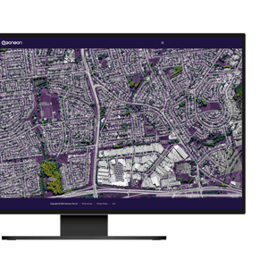
Geoneon's Vegetation Mapping is engineered to address these challenges, employing state-of-the-art satellite imagery combined with advanced artificial intelligence. Our technology offers unprecedented up to 30cm resolution mapping, enabling precise identification and categorisation of vegetation across the globe. With Geoneon, stakeholders in environmental conservation, urban planning, utilities, fire services, and agriculture can now access reliable, scalable, and highly detailed vegetation data, transforming the way we understand and manage the natural world.
Precise
High Accuracy
Leveraging AI algorithms, validated through terrestrial and aerial reference data, Geoneon's Vegetation Mapping at 30cm-resolution delivers unparalleled accuracy.
Global
Scalable and Global

A scalable dataset with transparent pricing, eliminating geographical limitations and minimising the dependency on traditional field measurements or airborne surveys.

Timely
Quick Turnaround

AI-powered processing not only accelerates the initial mapping process but also allows for fast and consistent updates.

Integration
Seamless Integration

Designed for easy integration into any GIS workflow without the need for complex system changes or specialised training.

TOUCH
Precise HIGH ACCURACY
HIGH ACCURACY
Leveraging AI algorithms, validated through terrestrial and aerial reference data, Geoneon's Vegetation Mapping at 30cm-resolution delivers unparalleled accuracy.
TOUCH
Global SCALABLE AND GLOBAL
SCALABLE AND GLOBAL

A scalable dataset with transparent pricing, eliminating geographical limitations and minimising the dependency on traditional field measurements or airborne surveys.

TOUCH
Timely QUICK TURNAROUND
QUICK TURNAROUND

AI-powered processing not only accelerates the initial mapping process but also allows for fast and consistent updates.

TOUCH
Integration SEAMLESS INTEGRATION
SEAMLESS INTEGRATION

Designed for easy integration into any GIS workflow without the need for complex system changes or specialised training.

Scalability and Granularity

Track Vegetation with Precision Everywhere

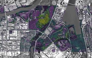
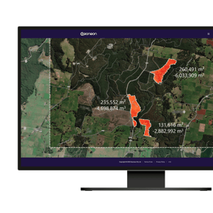
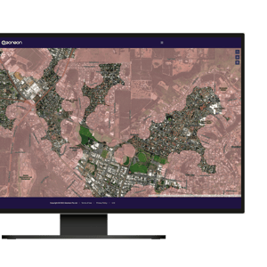
Our Vegetation Mapping can be used in the entire globe, simplifying the task of monitoring diverse vegetation types, regardless of their location. Observe changes in vegetation density and type across vast regions or zoom in on specific areas, down to individual trees. 

This global and high-resolution data, alleviates the necessity for physical site visits and manual  or airborne surveys, enhancing the understanding and management of vegetation without geographical constraints.
Satellite Imagery
Vegetation
Comparison-Satellite
Comparison-Vegetation

World Imagery Sources: Esri, DigitalGlobe, GeoEye, i-cubed, USDA FSA, USGS, AEX, Getmapping, Aerogrid, IGN, IGP, swisstopo, and the GIS User Community

Methodology and Technology

Enhanced by Lidar-Calibrated AI Models

Our Vegetation Mapping leverages AI models trained and calibrated with high-resolution Lidar (Light Detection and Ranging) data. Lidar is a remote sensing method that uses light in the form of a pulsed laser to measure variable distances to the Earth. These light pulses—combined with other data recorded by the airborne system—generate precise, three-dimensional information about the shape and surface characteristics of vegetation. This methodology provides an unparalleled level of detail in vegetation mapping, from expansive landscapes to the individual tree.

By integrating Lidar data, we ensure that our models have a robust foundation for accurately identifying and classifying various vegetation types globally. This precision drastically decreases the need for traditional, labour-intensive survey and mapping techniques, empowering stakeholders with advanced insights for the effective management and conservation of natural resources without the constraints of physical boundaries.
Vegetation-Satellite
01Visual Image
Calibration-Model
02Model Output
Calibration-Lidar
03Groundtruth from Lidar
Calibration-Comparison
04KDE of Output and Groundtruth

This figure showcases the integration and validation process of our Vegetation Mapping technology. Panel 01 presents a visual image of the terrain as captured by satellite, while Panel 02 displays the model output highlighting classified vegetation. Panel 03 provides the ground truth data derived from high-resolution LiDAR measurements, illustrating the detailed vegetation structure. Panel 04 compares the model output with the LiDAR ground truth through a Kernel Density Estimation (KDE), demonstrating the accuracy and precision of our mapping technique.

Vegetation Monitoring

Continuous Insight Through Time

In the dynamic world of vegetation management, the ability to monitor changes over time is indispensable. Geoneon's Vegetation Mapping provides an unparalleled solution, offering detailed insights into the evolution of both tree and low-lying vegetation across any landscape. By harnessing high-resolution satellite imagery at both 30cm and 10m scales, our technology captures the intricate details of vegetation growth, health, and changes from year to year, offering flexibility in resolution to suit various monitoring needs.

Our solution delivers a detailed, consistent mapping of vegetation changes over time, empowering stakeholders in forestry, agriculture, urban planning, and environmental conservation with the insights needed for informed decision-making.  This efficiency in mapping ensures time and resource conservation, aids strategic planning, risk assessment, and compliance monitoring, all while fostering environmental sustainability, enhancing operational efficiency, and improving safety measures.
Sample-2017_1x1
2017
Sample-2018_1x1
2018
Sample-2019_1x1
2019
Sample-2020_1x1
2020
Sample-2021_1x1
2021
Sample-2022_1x1
2022

This sequence of images, spanning from 2017 to 2022, illustrates the power of Geoneon's Vegetation Mapping in monitoring vegetation changes over time. Each panel captures the annual state of vegetation, showcasing the detailed progression of tree and low vegetation development at 30 cm resolution across six years.

Vegetation-Sample
It was fantastic to work with the team at Geoneon on this project to delve more deeply into canopy cover across the City of Hobart- we now have the knowledge to be more targeted in our approach to urban greening.
Photo-Karen-Abey
Karen AbeyActing Director City Life, City of Hobart
Pricing Overview

Choose Your Resolution

Select from our range of vegetation mapping options to get the precise data you need. Each tier is tailored to suit various project scopes and detail requirements. Whether you are monitoring large tracts of land or need intricate detail for urban development, our pricing plans are designed to meet your project's specific needs with clarity and precision. Contact our sales team to find the best fit for your vegetation mapping objectives.
  • Standard: 10m resolution mapping, perfect for wide-area tree canopy and low vegetation coverage assessments.
  • High-Res: 30cm resolution mapping offers exceptional detail for nuanced urban and infrastructure planning.
  • Combined: A customised solution that provides both 10m and 30cm resolutions for comprehensive, multi-scale project insights.

Standard

AU$2/km2
Datasets Included
Tree Canopy Cover
Low Vegetation

Sample-2024-10m_1x1

Product Description

Provides essential 10 m resolution mapping for broad areas.

Minimum order of 1,000km2.

High-Res

AU$200/km2
Datasets Included
Tree Canopy Cover
Low Vegetation

Sample-2022_1x1

Product Description

Delivers detailed 30cm resolution mapping critical for applications in urban and infrastructure settings.

Minimum order of 100 km2.

Combined

Contact us for pricing
Datasets Included
Tree Canopy Cover
Low Vegetation

Combined-10m-30cm

Product Description

Combines 10m and 30cm resolution mapping for versatile urban and rural projects.

Minimum order of 500km2

Additional Services

  • Advanced data analysis and reporting tailored to specific client needs. (Contact for pricing)
  • Assistance with integrating Geoneon data into existing systems or workflows. (Contact for pricing)

Notes

  • Bulk discounts may apply for large-area contracts.
  • Custom coverage areas and additional resolutions may be available upon request.
Vegetation-Overview

Get a glimpse of the future of vegetation management.

Experience the power of high-resolution mapping to enhance your environmental and infrastructure projects. 

Frequently Asked Questions

Your Questions, Answered

What is Vegetation Mapping?

Vegetation Mapping is a way to create detailed pictures or maps showing the types and locations of plants in an area. Geoneon's Vegetation Mapping uses advanced satellites and AI (Artificial Intelligence) to make these maps with very high precision, down to 30cm detail.

What sets Geoneon apart is how we combine the latest technology to see the Earth from space with smart computer programs that learn from data. This method is faster and covers more ground than older ways, like having people go out and survey the land by hand or using planes. It means we can quickly give you a clear view of large areas, helping in everything from city planning to farming and keeping nature safe.

What resolutions are available?

Geoneon offers two main types of Vegetation Mapping: one with a 10-metre (10m Standard) resolution and another with a 30-centimetre (30cm High-Res) resolution.

The 10m Standard option shows you a broader view, like looking at a forest from far away. It is great for seeing big areas all at once, useful for large-scale projects or getting an overall picture of vegetation cover.

The 30cm High-Res option is like using a magnifying glass to see details up close, perfect for spotting individual trees. It is ideal for projects that need a detailed look at a smaller area, such as urban planning, precision agriculture, or detailed environmental studies.

Choosing the right one depends on your project's needs. If you need a detailed view for a specific, smaller area, go with 30cm High-Res. If you are looking at a large area and need a general overview, the 10m Standard is likely the best fit.

Does it integrate into existing GIS workflows?

Yes, you can integrate Geoneon's data into your existing GIS workflow. Since our vegetation mapping is provided as a shapefile, a common format used in GIS systems, it makes integration straightforward.
Here is how you do it:

  1. Download the Shapefile: After purchasing or accessing Geoneon's data, you will download a shapefile package.
  2. Open Your GIS Software: Use any standard GIS software you already work with.
  3. Import the Shapefile: Within your GIS software, there is usually an option to "Add Data" or "Import Layer." Select this and navigate to where you've saved the Geoneon shapefile.
  4. Analyse and Use: With the data now in your GIS system, you can start analysing and incorporating it into your projects.
How often is the data updated?

For our 10m Standard vegetation mapping, the data gets updated up to every 10 days.

For the 30cm High-Res mapping, the updates occur approximately every day.

The exact frequency can vary based on several factors, including the satellite's orbit and environmental conditions like cloud cover. While we strive to provide the most current data possible, there might be times when acquiring fresh high-res imagery of a specific location could take a little longer.

For specific projects, we can discuss how to best match the update frequency to your needs, but there might be some limitations based on the technology's natural cycle and external factors like cloud cover.

Is historical data available?

Yes, Geoneon provides access to historical vegetation data.

For both our 10m Standard and 30cm High-Res mapping, you can look back at vegetation changes using data that goes back to 2015.

Keep in mind, though, that the availability of historical data can be limited by several factors. Satellites don't capture data continuously, leading to periods where specific areas might not have been imaged. Environmental conditions, such as cloud cover, can also impact the quality and frequency of data acquisition. Additionally, the satellite's operational schedule and targeted areas might result in gaps in the historical data for some regions. These limitations mean that while a wealth of historical vegetation data is available, there may be inconsistencies in coverage over time and space.

How can I get a sample?

Yes, you can get a sample of our vegetation mapping data to check its quality and see how it fits your needs before you decide to buy. Just visit this link to download the sample dataset.

Vegetation-Overview

Ready to transform your approach to vegetation mapping with unparalleled precision and ease?

Click the button below to get in touch with our sales team today. Start your journey toward smarter, more efficient vegetation management now.