
Skip to content

Tasmania Wildfire Index 2026

A statewide view of modelled wildfire conditions and building exposure to support local governments and communities in long-term preparedness and planning.

STATEWIDE OVERVIEW

Headline findings

38,950 assessed building footprints (8.6%) are in WEI classes 7–10. These classes support comparison and reporting; they are not a separate risk category, and lower classes are not risk-free.

450,356 building footprints assessed
29 local government areas
769 suburbs
8.6% of footprints in WEI classes 7–10
EXPLORE

Interactive map

Preview modelled wildfire severity and building exposure across Tasmania.

WSI AND WEI

What the Index shows

Wildfire Severity Index (WSI) provides a relative view of modelled landscape conditions based on vegetation and fuel, topography, and climate and dryness.

Wildfire Exposure Index (WEI) summarises modelled WSI conditions around assessed building footprints to provide a relative view of exposure.

Count and proportional-share findings answer different questions and should be interpreted separately. Detailed numerical findings are available in the 2026 report.
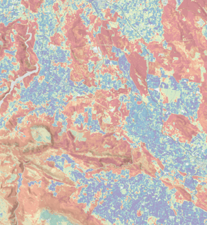
Map artwork from the Tasmania Wildfire Index 2026 report cover
APPROPRIATE USE

Methodology, appropriate use and limitations

Appropriate uses

Use the Index for statewide and regional screening, preparedness and planning, comparison using explicit denominators, and identifying areas for further investigation.

What the Index is not

It is not a probability of fire, live warning, fire-spread forecast, property-level risk or measure of building vulnerability. It is not an evacuation guide, insurance or financial decision rule, regulatory decision rule, substitute for professional advice, or substitute for official emergency information.

Refer to the 2026 report for methodology, provenance, interpretation guidance and the full disclaimer.

VERSION 1.0 · 20 SEPTEMBER 2026

Download the report

Read the complete methodology, findings, interpretation guidance and limitations in the formal publication.

Tasmania Wildfire Index 2026 - Version 1.0
Published 20 September 2026.
Cover of the Tasmania Wildfire Index 2026 report
OFFICIAL RESOURCES

Bushfire preparedness and emergency information

The Tasmania Wildfire Index is a long-term screening and planning resource. For bushfire preparedness, current warnings and emergency information, use official Tasmania Fire Service resources.

Tasmania Fire Service — Bushfire: Why Risk It? provides guidance on creating a Bushfire Plan, preparing your property and emergency kit, understanding Fire Danger Ratings and bushfire warnings, and knowing when and where to leave. It also links to current TasALERT warnings, fire bans, weather information, Bushfire Ready Neighbourhoods and other community preparedness resources.

Visit Tasmania Fire Service resources

ABOUT THE PROJECT

Acknowledgements

The Tasmania Wildfire Index 2026 was developed and funded by Geoneon, with support from Kingborough Council.

Discuss your wildfire planning needs

If your organisation is considering a related planning, monitoring or spatial-analysis question, talk with Geoneon about your project.