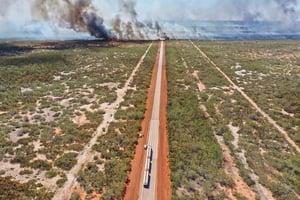
The Shire of Dundas in Western Australia spans a vast area and serves as a major stopping point for freight and travelers. This region faced immense challenges when wildfires blazed across 550,000 hectares of its land. Critical supply routes, including the Eyre Highway, faced disruptions.
A review by the State Emergency Management Committee of Western Australia spotlighted the vulnerabilities of these vital routes. The wildfires' aftermath led to a collaborative approach to manage future risks, with Geoneon leveraging high-resolution satellite imagery, elevation models, and analytics to provide an insightful vulnerability assessment.
